Benin
Background:
Present day Benin was the site of Dahomey, a prominent West African kingdom that rose in the 15th century. The territory became a French Colony in 1872 and achieved independence on 1 august 1960, as the Republic of Benin. A succession of military governments ended in 1972 with the rise to power of Mathieu Kerekou and the establishment of a government based on Marxist-Leninist principles. A move to representative government began in 1989. Two years later, free elections ushered in former Prime Minister Nicephore Soglo as president, marking the first successful transfer of power in Africa from a dictatorship to a democracy. Kerekou was returned to power by elections held in 1996 and 2001, though some irregularities were alleged.
Location:
Western Africa, bordering the Bight of Benin, between Nigeria and Togo
Geographic coordinates:
9 30 N, 2 15 E
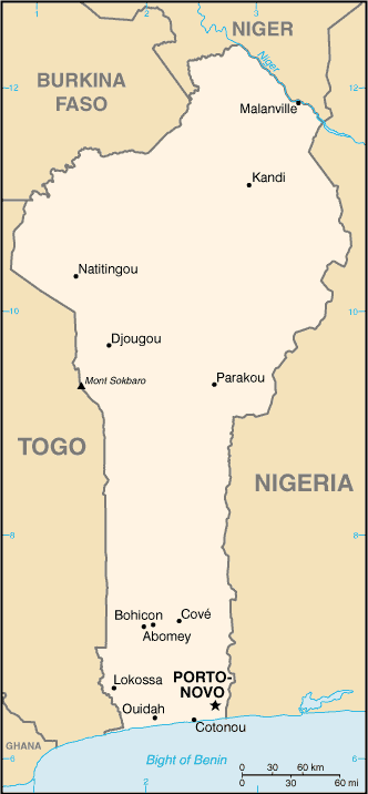
Map references:
Africa
Area:
Total: 112,620 sq km
Land: 110,620 sq km
Water: 2,000 sq km
Area-comparative:
slightly smaller than Pennsylvania
Land boundaries:
Total: 1,989 km
Border countries: Burkina Faso 306 km, Niger 266 km, Nigeria 773 km, Togo 644 km
Coastline:
121 km
Maritime claims:
Territorial sea: 200 nm
Climate:
tropical; hot, humid in south; semiarid in north
Terrain:
mostly flat to undulating plain; some hills and low mountains
Elevation extremes:
Lowest point: Atlantic Ocean 0 m
Highest point: Mont Sokbaro 658 m
Natural resources:
small offshore oil deposits, limestone, marble, timber
Land use:
Arable land: 18.08%
Permanent crops: 2.4%
Other: 79.52% (2001)
Irrigated land:
120 sq km (1998 est.)
Natural hazards:
hot, dry, dusty harmattan wind may affect north from december to march
Environment-current issues:
inadequate supplies of potable water; poaching threatens wildlife populations; deforestation; desertification
Environment-international agreements:
Party to: Biodiversity, Climate Change, Climate Change-Kyoto Protocol, Desertification, Endangered Species, Environmental Modification, Hazardous Wastes, Law of the Sea, Ozone Layer Protection, Ship Pollution, Wetlands
signed, but not ratified: none of the selected agreements
Geography -note:
sandbanks create difficult access to a coast with no natural harbors, river mouths, or islands
Population:
7,460,025
Note: estimates for this country explicitly take into account the effects of excess mortality due to AIDS; this can result in lower life expectancy, higher infant mortality and death rates, lower population and growth rates, and changes in the distribution of population by age and sex than would otherwise be expected (july 2005 est.)
Age structure:
0-14 years: 46.5% (male 1,752,243/female 1,719,458)
15-64 years: 51.2% (male 1,868,630/female 1,948,610)
65 years and over: 2.3% (male 70,367/female 100,717) (2005 est.)
Median age:
Total: 16.56 years
Male: 16.12 years
Female: 17.01 years (2005 est.)
Population growth rate:
2.82% (2005 est.)
Birth rate:
41.99 births/1,000 population (2005 est.)
Death rate:
13.76 deaths/1,000 population (2005 est.)
Net migration rate:
0 migrant(s)/1,000 population (2005 est.)
Sex ratio:
At birth: 1.03 male(s)/female
Under 15 years: 1.02 male(s)/female
15-64 years: 0.96 male(s)/female
Total population: 0.98 male(s)/female (2005 est.)
Infant mortality rate:
Total: 85 deaths/1,000 live births
Male: 90 deaths/1,000 live births
Female: 79.86 deaths/1,000 live births (2005 est.)
Life expectancy at birth:
Total population: 50.51 years
Male: 50.14 years
Female: 50.89 years (2005 est.)
Total fertility rate:
5.86 children born/woman (2005 est.)
HIV/AIDS-adult prevalence rate:
1.9% (2003 est.)
HIV/AIDS-people living with HIV/AIDS:
68,000 (2003 est.)
HIV/AIDS-deaths:
5,800 (2003 est.)
Major infectious diseases:
Degree of risk: very high
Food or waterborne diseases: bacterial and protozoal diarrhea, hepatitis A, and typhoid fever
Vectorborne diseases: malaria, yellow fever, and others are high risks in some locations
Respiratory disease: meningococcal meningitis (2004)
Nationality:
Noun: Beninese (singular and plural)
Adjective: Beninese
Ethnic groups:
African 99% (42 ethnic groups, most important being Fon, Adja, Yoruba, Bariba), Europeans 5,500
Religions:
indigenous beliefs 50%, Christian 30%, Muslim 20%
Languages:
French (official), Fon and Yoruba (most common vernaculars in south), tribal languages (at least six major ones in north)
Literacy:
Definition: age 15 and over can read and write
Total population: 40.9%
Male: 56.2%
Female: 26.5% (2000)
Government type:
republic under multiparty democratic rule; DROP ped Marxism-Leninism december 1989
Capital:
Porto-Novo is the official capital; Cotonou is the seat of government
Administrative divisions:
12 departments; Alibori, Atakora, Atlantique, Borgou, Collines, Kouffo, Donga, Littoral, Mono, Oueme, Plateau, Zou
Independence:
1 august 1960 (from France)
National holiday:
National Day, 1 august (1960)
Constitution:
december 1990
Legal system:
based on French civil law and customary law; has not accepted compulsory ICJ jurisdiction
Suffrage:
18 years of age; universal
Executive branch:
Chief of state: President Mathieu Kerekou (since 4 april 1996); note - the president is both the chief of state and head of government
Head of government: President Mathieu Kerekou (since 4 april 1996); note - the president is both the chief of state and head of government
Cabinet: Council of Ministers appointed by the president
Elections: president reelected by popular vote for a five-year term; runoff election held 22 march 2001 (next to be held march 2006)
Election results: Mathieu Kerekou reelected president; percent of vote - Mathieu Kerekou 84.1%, Bruno Amoussou 15.9%
Note: the four top-ranking contenders following the first-round presidential elections were: Mathieu Kerekou (incumbent) 45.4%, Nicephore Soglo (former president) 27.1%, Adrien HoungbedjiI (National Assembly Speaker) 12.6%, and Bruno Amoussou (Minister of State) 8.6%; the second-round balloting, originally scheduled for 18 march 2001, was postponed four days because both Soglo and Houngbedji withdrew alleging electoral fraud; this left Keekou to run against his own Minister of State, Amoussou, in what was termed a "friendly match"
Legislative branch:
unicameral National Assembly or Assemblee Nationale (83 seats; members are elected by direct popular vote to serve four-year terms)
Elections: last held 30 march 2003 (next to be held march 2007)
Election results: percent of vote by party - NA%; seats by party - Presidential Movement 52, opposition (PRB, PRD, E'toile, and 5 other small parties) 31
Judicial branch:
Constitutional Court or Cour Constitutionnelle; Supreme Court or Cour Supreme; High Court of Justice
Political parties and leaders:
African Congress for Renewal or DUNYA [Saka Saley];
African Movement for Democracy and Progress or MADEP [Sefou Fagbohoun];
Alliance of the Social Democratic Party or PSD [Bruno Amoussou];
Coalition of Democratic Forces [Gatien Houngbedji];
Democratic Renewal Party or PRD [Adrien Houngbedji];
Front for Renewal and Development or FARD-ALAFIA [Jerome Sakia Kina];
Impulse for Progress and Democracy or IPD [Bertin Borna];
Key Force or FC [leader NA];
Presidential Movement (UBF, MADEP, FC, IDP, and four small parties); Renaissance Party du Benin or PRB [Nicephore Soglo];
The Star Alliance (Alliance E'toile) [Sacca L afia];
Union of Tomorrow's Benin or UBF [Bruno Amoussou]
Note: approximately 20 additional minor parties
Political pressure groups and leaders:
NA
International organization participation:
ACCT, ACP, AfDB, AU, ECOWAS, Entente, FAO, FZ, G-77, IAEA, IBRD, ICAO, ICCt, ICFTU, ICRM, IDA, IDB, IFAD, IFC, IFRCS, ILO, IMF, IMO, Interpol, IOC, IOM, ISO (correspondent), ITU, MIGA, MINUSTAH, MONUC, NAM, OIC, ONUB, OPCW, UN, UN Security Council (temporary), UNCTAD, UNESCO, UNIDO, UNMIL, UNOCI, UPU, WADB (regional), WAEMU, WCL, WCO, WFTU, WHO, WIPO, WMO, WToO, WTO
Diplomatic representation in the US:
Chief of mission: Ambassador Cyrille Segbe Ogun
Chancery: 2124 Kalorama Road NW, Washington, DC 20008
Telephone: [1] (202) 232-6656
Fax: [1] (202) 265-1996
Diplomatic representation from the US:
Chief of mission: Ambassador Wayne Neill
Embassy: Rue Caporal Bernard Anani, Cotonou
Mailing address: 01 B. P. 2012, Cotonou
Telephone: [229] 30-06-50
Fax: [229] 30-06-70
Flag description:
two equal horizontal bands of yellow (top) and red (bottom) with a vertical green band on the hoist side
Economy-overview:
The economy of Benin remains underdeveloped and dependent on subsistence agriculture, cotton production, and regional trade. Growth in real output has averaged around 5% in the past six years, but rapid population growth has offset much of this increase. Inflation has subsided over the past several years. In order to raise growth still further, Benin plans to attract more foreign investment, place more emphasis on tourism, facilitate the development of new food processing systems and agricultural products, and encourage new information and communication technology.
The 2001 privatization policy should continue in telecommunications, water, electricity, and agriculture in spite of initial government reluctance. The Paris Club and bilateral creditors have eased the external debt situation, while pressing for more rapid structural reforms. Benin continues to be hurt by Nigerian trade protection that bans imports of a growing list of products from Benin and elsewhere. As a result, smuggling and criminality along the Benin-Nigeria border has been on the rise.
GDP:
purchasing power parity - $8.338 billion (2004 est.)
GDP-real growth rate:
5% (2004 est.)
GDP-per capita:
purchasing power parity - $1,200 (2004 est.)
GDP-composition by sector:
Agriculture: 36.3%
Industry: 14.3%
Services: 49.4% (2004 est.)
Investment (gross fixed):
19.3% of GDP (2004 est.)
Population below poverty line:
33% (2001 est.)
Household income or consumption by percentage share:
Lowest 10%: NA
Highest 10%: NA
Inflation rate (consumer prices):
2.8% (2004 est.)
Labor force:
NA (1996)
Unemployment rate:
NA
Budget:
Revenues: $869.4 million
Expenditures: $720.4 million, including capital expenditures of NA (2004 est.)
Agriculture-products:
cotton, corn, cassava (tapioca), yams, beans, palm oil, peanuts, livestock (2001)
Industries:
textiles, food processing, construction materials, cement (2001)
Industrial production growth rate:
8.3% (2001 est.)
Electricity-production:
285.2 million kWh (2002)
Electricity-consumption:
565.2 million kWh (2002)
Electricity-exports:
0 kWh (2002)
Electricity-imports:
300 million kWh (2002)
Oil-production:
700 bbl/day (2001 est.)
Oil-consumption:
11,500 bbl/day (2001 est.)
Oil-exports:
NA
Oil-imports:
NA
Oil-proved reserves:
4.105 million bbl (1 january 2002)
Natural gas-proved reserves:
608.8 million cu m (1 january 2002)
Current account balance:
$-159.9 million (2004 est.)
Exports:
$720.9 million f.o.b. (2004 est.)
Exports-commodities:
cotton, crude oil, palm products, cocoa
Exports-partners:
China 30.2%, India 15.6%, Thailand 6%, Ghana 5.9%, Niger 4.5% (2004)
Imports:
$934.5 million f.o.b. (2004 est.)
Imports-commodities:
foodstuffs, capital goods, petroleum products
Imports-partners:
China 29.7%, France 13.8%, Thailand 7.2%, Cote d'Ivoire 4.6% (2004)
Reserves of foreign exchange and gold:
$839.3 million (2004 est.)
Debt-external:
$1.6 billion (2000)
Economic aid-recipient:
$342.6 million (2000)
Currency:
Communaute Financiere Africaine franc (XOF); note - responsible authority is the Central Bank of the West African States
Currency code:
XOF
Exchange rates:
Communaute Financiere Africaine francs (XOF) per US dollar - 528.29 (2004), 581.2 (2003), 696.99 (2002), 733.04 (2001), 711.98 (2000)
Fiscal year:
calendar year
Telephones-main lines in use:
66,500 (2003)
Telephones-mobile cellular:
236,200 (2003)
Telephone system:
General assessment: NA
Domestic: fair system of open-wire, microwave radio relay, and cellular connections
International: country code - 229; satellite earth station - 1 Intelsat (Atlantic Ocean); fiber optic submarine cable (SAT-3/WASC) provides connectivity to Europe and Asia
Radio broadcast stations:
AM 2, FM 9, shortwave 4 (2000)
Television broadcast stations:
1 (2001)
Internet country code:
.bj
Internet hosts:
879 (2004)
Internet users:
70,000 (2003)
Railways:
Ttal: 578 km
Narrow gauge: 578 km 1.000-m gauge (2003)
Highways:
Total: 6,787 km
Paved: 1,357 km (including 10 km of expressways)
unpaved: 5,430 km (1999 est.)
Waterways:
150 km (on River Niger along northern border) (2004)
Ports and harbors:
Cotonou, Porto-Novo
Airports:
5 (2004 est.)
Airports-with paved runways:
Total: 1
1,524 to 2,437 m: 1 (2004 est.)
Airports-with unpaved runways:
Total: 4
2,438 to 3,047 m: 1
1,524 to 2,437 m: 1
914 to 1,523 m: 2 (2004 est.)
Military branches:
Army, Navy, Air Force
Military manpower-military age and obligation:
21 years of age for compulsory and voluntary military service; in practice, volunteers may be taken at the age of 18; both sexes are eligible for military service; conscript tour of duty - 18 months (2004)
Military manpower-availability:
Males age 21-49: 1,207,071
Females age 21-49: 1,216,180 (2005 est.)
Military manpower-fit for military service:
Males age 21-49: 670,170
Females age 21-49: 630,078 (2005 est.)
Military manpower-reaching military age annually:
Males: 72,841
Females: 71,428 (2005 est.)
Military expenditures-dollar figure:
$96.5 million (2004)
Military expenditures-percent of GDP:
2.4% (2004)
Disputes-international:
two villages remain in dispute along the border with Burkina Faso; accuses Burkina Faso of moving boundary pillars; much of Benin-Niger boundary, including tripoint with Nigeria, remains undemarcated, and the states expect a ruling in 2005 from the ICJ over the disputed Niger and Mekrou River islands; a joint task force was established in 2004 that resolved disputes over and redrew the maritime and the 870-km land boundary with Nigeria, including the sovereignty over seven villages along the Okpara River; a joint boundary commission continues to resurvey the boundary with Togo to verify Benin's claim that Togo moved boundary stones
Illicit drugs:
transshipment point for narcotics associated with Nigerian trafficking organizations and most commonly destined for Western Europe and the US; vulnerable to money laundering due to a poorly regulated financial infrastructure
Línea Nacional: 018000912101
Calle 70 No 7-30, Piso 8, Bogotá; D.C. (Colombia)
Tel: (601)4255255 Ext. 1415. Cel: 3115617580
Footer local